World Political Map
- Publisher : Fingerprint Publishing/ Prakash Books
- Publishing year : March 2018
- Binding : Paperback
- ISBN : 9789354400650
- Imprint : Wonder House Books
- Age Group : Young Reader
- Language : English
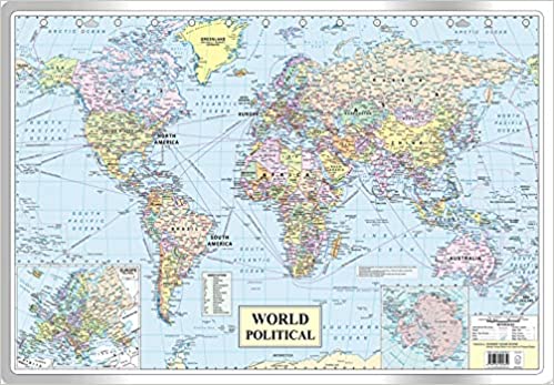
This is a syllabus friendly political map of the world meant for students. The student can study about the geographical ...
This is a syllabus friendly political map of the world meant for students. The student can study about the geographical locations of countries, their capitals and other important cities. It also depicts major shipping routes, sea ports, air ports and National highways. The map depicts the accurate flow of Rivers and lakes. These additional valuable information will help the student learn more about the world's Geography. The map is sturdy and can withstand lot of wear and tear without getting crumpled. The map is easy to hang on a wall with a nail. The dimensions of the map are 30 inches X 20 inches and have been approved by survey of India. This map is also useful for UPSC, SSC, Banking, Railways and other competitive exam preparations.
.jpeg)
.jpeg)
.jpeg)